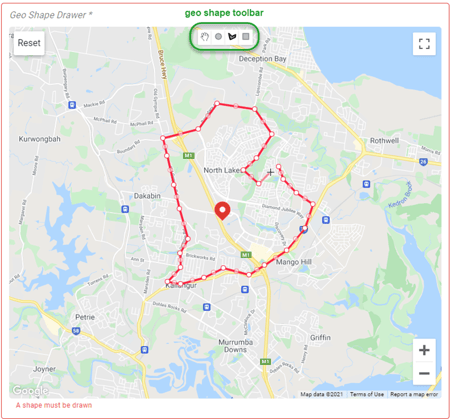
Geo Shapes permits the user to define the geographical borders for delivery areas applicable to each store by drawing the border on a map.
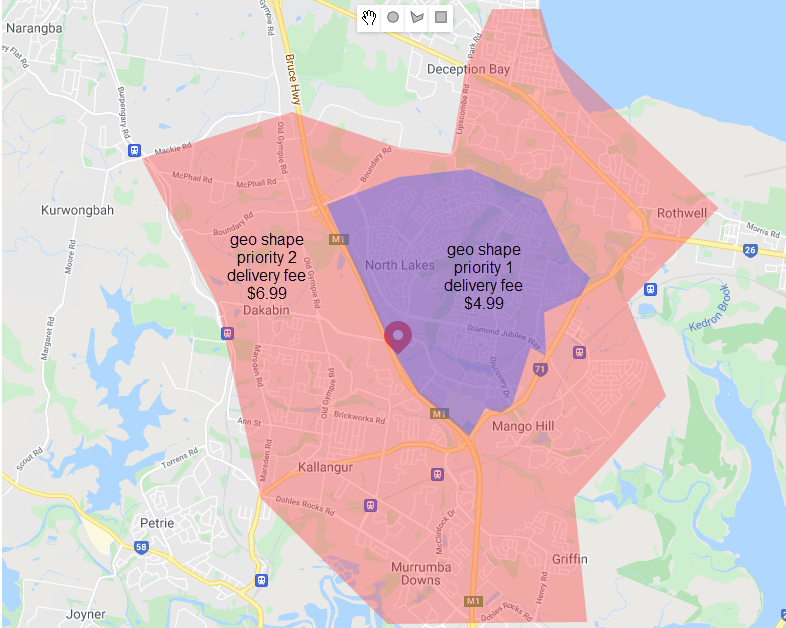
Consideration can then be given to geographical, topographical, or structural features when determining the delivery areas that will best maintain the standard of delivered food.
A location may have multiple Geo Shapes applied where each is assigned a priority ranking and applicable delivery fee.
The map is displayed with a pin dropped for the selected location, then draw your shape with the Circle, Shape, or Rectangle from the toolbar